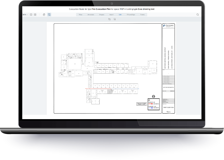
With Evacuation Routes you can:
- Create, save, and print multiple evacuation routes for every room and space in your district.
- Keep all evacuation drawings organized by building and space for easy access and management.
- Track changes and maintain up‑to‑date, compliant diagrams across your entire district.
- Generate drawings suitable for hallway display or digital distribution.
- Distribute digital diagrams or produce print‑ready versions for staff, students, and first responders.
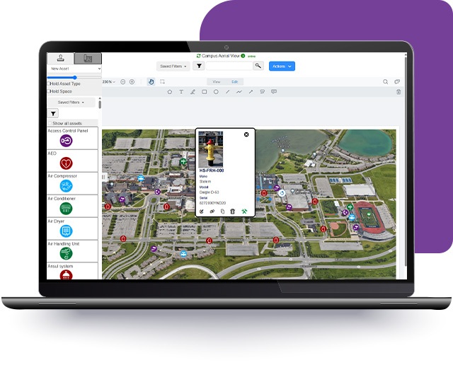
Explore the Full Potential of Facilities Drawings
Facilities Drawings
Facilities Drawings is our interactive floorplan tool that provides a quick and easy way to access, edit, and customize your floorplan drawings.
Need help?
We can assist with Evacuation Route setup, taking the work off your plate and bringing a second set of eyes to identify safety gaps and routing errors.
Contact Us