
What We Deliver
Our Evacuation Drawings Professional Service transforms outdated, paper-based, or hand-drawn exit maps into clean, standardized emergency diagrams within Facilities Drawings. Whether you’re working from text-based plans, legacy visuals, or need a complete overhaul, our team will do the heavy lifting—building detailed, editable evacuation routes inside your existing Facilities Drawings system.
We offer:
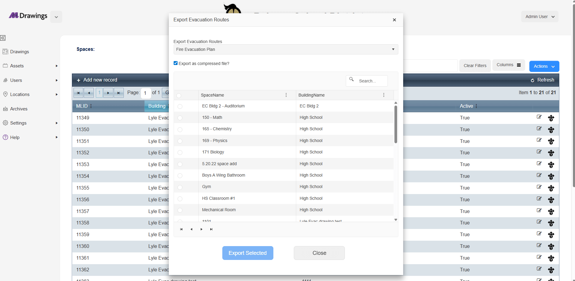
- Digitized evacuation maps for every space in your district
- Professional design and layout review to catch routing or labeling errors
- Ready-to-export diagrams that meet safety compliance standards
- Multiple routes per room, fast revisions, and easy sharing
With us, you gain more than visuals—you gain peace of mind.
Why It Matters
Emergency evacuation drawings aren’t just school posters. They’re mission-critical tools that save lives in high-stress moments. Whether it’s a fire, lockdown, or natural disaster, clarity and accuracy are non-negotiable.
Top reasons districts trust us with their drawings:
- Student & Staff Safety
Reduce panic during emergencies with clear, easy-to-follow diagrams - Regulatory Compliance
Meet local, state, and federal safety posting requirements - Emergency Preparedness
Standardize visuals for drills, staff training, and audit readiness - Support for First Responders
Give police and fire teams faster access with accurate building layouts - Inclusive Safety Planning
Help ESL, non-verbal, and neurodiverse students understand instructions
If your district is relying on PDFs or disconnected paper copies, this service offers a scalable, centralized solution.
Who It's For
- Facilities Directors looking for streamlined updates across multiple buildings
- District Admins tasked with safety compliance and inspections
- IT & Operations Teams supporting digital modernization
- First Responders who need fast access to accurate layouts
- All public and private K–12 schools—works for districts of all sizes
How It Works
- You send us your existing drawings (hand-drawn, PDFs, or text-based route instructions)
- Our team digitizes and standardizes each drawing directly into your Faculties Drawings system
- We include:
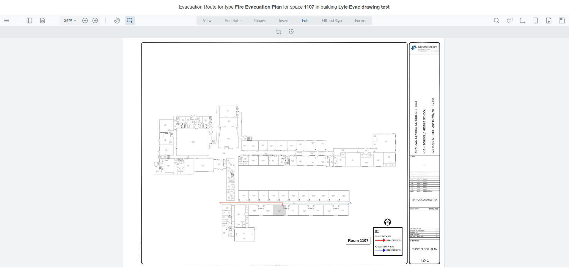
- Emergency route lines
- Room labels
- You review, approve, and export—whenever you’re ready
Need additional edits? The Faculties Drawings platform makes updates fast and intuitive.

Let’s Get Started
Whether you're updating evacuation maps for a new building or bringing your entire district up to code, our Pro Services team is ready to help.
Request a Quote